Gocław, Szczecin
Appearance
Gocław | |
|---|---|
 Aerial view of Gocław | |
| Coordinates: 53°28′32″N 14°36′15″E / 53.4756°N 14.6043°E | |
| Country | |
| Voivodeship | West Pomeranian |
| County/City | Szczecin |
| Neighbourhood | Golęcino-Gocław |
| Time zone | UTC+1 (CET) |
| • Summer (DST) | UTC+2 (CEST) |
| Vehicle registration | ZS |
| Primary airport | Solidarity Szczecin–Goleniów Airport |
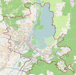
Gocław is a part of the city of Szczecin, Poland.[1] It is located on the left bank of the Oder river, in the northern part of the city.[2]
History
[edit]The area became part of the emerging Polish state under its first ruler Mieszko I around 967,[3][4] and following Poland's fragmentation it formed part of the Duchy of Pomerania. During the Thirty Years' War, the settlement fell to the Swedish Empire. Later on, it passed to Prussia, and from 1871 to 1945 it was part of Germany, within which it was known as Gotzlow.[2] The place became well known since a huge Bismarck tower, now known as the Gocław Tower, had been built on top of a hill in the vicinity of the river Oder.
Wikimedia Commons has media related to Gocław (Szczecin).
References
[edit]- ^ Rozporządzenie Ministra Administracji i Cyfryzacji z dnia 13 grudnia 2012 r. w sprawie wykazu urzędowych nazw miejscowości i ich części, Dz. U., 2013, No. 200
- ^ a b Encyclopedia of Szczecin. Vol. I, A-O. Szczecin: University of Szczecin, 1999, p. 293. ISBN 83-87341-45-2 (pl)
- ^ "Szczecin - Największe atrakcje". WP Turystyka (in Polish). Retrieved 25 December 2024.
- ^ Labuda, Gerard (1993). "Chrystianizacja Pomorza (X–XIII stulecie)". Studia Gdańskie (in Polish). Vol. IX. Gdańsk-Oliwa. p. 47.


